Iran
2009-08-19 16:42 BJTSpecial Report: Asia Pacific |
 Mail
Mail Share
Share Print
Print
Location :
Iran is situated in south-western Asia and borders the three CIS states, the Republic of Armenia, the Republic of Azerbaijan, and the Republic of Turkmenistan, as well as the Caspian Seas to the north, Turkey and Iraq to the west, the Persian Gulf and the Gulf of Oman to the south and Pakistan and Afghanistan to the east.
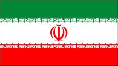 |
| Iran Flag |
Landscape :
A series of massive, heavily eroded mountain ranges surround Iran's high interior basin. Most of the country is above 1,500 feet, one-sixth of it over 6,500 high. In sharp contrast are the coastal regions outside the mountain ring. In the north, the 400-mile strip along the Caspian Sea, never more than 70 miles wide and frequently narrowing to 10, falls sharply from the 10,000-foot summit to 90 feet below sea level. In the south, the land drops away from a 2,000 foot plateau, backed by a rugged escarpment three times as high, to meet the Persian Gulf and the Gulf of Oman.
Mountains :
The Zagros range stretches from the border with the Republic of Armenia in the north-west to the Persian Gulf, and then eastward into Baluchistan. As it moves southward, it broadens into a 125-mile-wide band of parallel, alternating mountains lying between the plains of Mesopotamia and the great central plateau of Iran. It is drained on the west by streams that cut deep, narrow gorges and water fertile valleys. The land is extremely hard, difficult to access, and populated largely by pastoral nomads.
The Alborz mountain range, narrower than the Zagros but equally forbidding, runs along the Zagros but equally forbidding, runs along the southern shore of the Caspian to meet the border ranges of Khorassan to the east. The highest of its volcanic peaks is 18,600-foot, snow-covered Mt. Damavand. On the border of Afghanistan, the mountains fall away, to be replaced by barren sand dunes.
The arid interior plateau, which extends into Central Asia, is cut by two smaller mountain ranges. Parts of this desert region, known as dasht, are covered by loose stones and sand, gradually merging into fertile soil on the hillsides. Where fresh water can be held, oases have existed from time immemorial, marking the ancient caravan routes. The most remarkable feature of the plateau is a salt waste 200 miles long and half as wide, knows as the kavir (deserts). It remains unexplored, since its treacherous crust has been formed by large, sharp-edged salt masses which cover mud. Cut by deep ravines, it is virtually impenetrable.
Deserts :
The vast deserts of Iran stretch across the plateau from the north-west, close to Tehran and Qom, for a distance of about 400 miles to the south-east and beyond the frontier. Approximately one-sixth of the total area of Iran is barren desert.
The two largest desert areas are known as the Kavir-e-Lut and the Dasht-e-Kavir. Third in size of these deserts is the Jazmurian. It is often said that the Kavir-e-Lut and Dasht-e-Kavir are impossible to cross except by the single road which runs from Yazd to Ferdows, but in recent years, heavy trucks and other vehicles have travelled over long stretches of these deserts which contain extensive mineral deposits -chlorides, sulphates and carbonates - and it is only a matter of time before they are exploited.


 Video
Video


On CCTV
Get the Channel, CCTV Live, CCTV Live in HD, CCTV-5 (Sports) Live, Latest Video, TV ScheduleCCTV-9 News Programs
Asia Today, Biz China, CCTV News, China This Week, China Today, Culture Express, Dialogue, News Hour, Sports Scene, World Insight, World Wide Watch
Newsletter
RSS
Site Map
|
Contact Us
|
About Us
|
FAQ
|
Jobs
|
Advertise
|
Privacy Policy
|
Terms of Use
 2009 China Central Television. All Rights Reserved