Mongolia
2009-08-19 14:32 BJTSpecial Report: Asia Pacific |
 Mail
Mail Share
Share Print
Print
Mongolia is in central Asia and covers 1,564,100 sq km, between 87047' and 119057' east and 41035' and 52006' north. It shares a 3,485km border with Russia to the north and a 4,677km border with China to the south. From west to east, the country is 2,392km; from north to south it is 1,259km. The average altitude is 1,580 meters above sea-level, and Mongolia is landlocked country. For many centuries, travelers have admired Mongolia for its clear sunny skies and the range of natural features, from high mountains and valleys, wide steppes, Gobi desert and semi-desert.
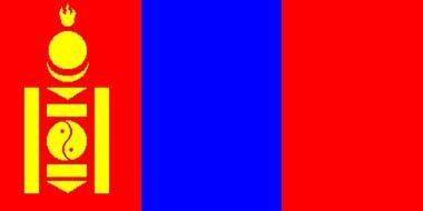 |
| Mongolia Flag |
Geography
Mongolian topography consists of mountains, hummocks and high denudation plains, with three major regional stages. Erosive mountain relief and depressions of tectonic origin formed during the late Cretaceous and early Quaternary periods are numerous in the north. Erosion, tectonic depression and humps of folded mountains, lifted during the Cretaceous period's fourth stage, occur frequently. Eighty per cent of all Mongolia is about 1,000 metres above sea level. Mongolia has most of the Mongol Altai Mountains, the Great Lakes Depression, mountains surrounding Lake Khuvsgul, the Khangai mountain range, the Orkhon-Selenge river basin, Khentii Mountain, Dornod Steppe and Great Khyangan Mountain eastwards. The Mongol Altai Mountains in the west run for 600-650km, with thin hills, hollows and precipitous crags of over 4,000 metres. The Khuiten peak of the Altai Tavan Bogd Mountain is the highest point in the country, at 4,374 metres. There are glaciers in the heights of the Mongol Altai, and the humps and hollows of the ice-age period remain in Khuvsgul, Khangai, Khentii and the Altai mountains.
The Great Lakes Depression is in the east of the Mongol Altai and has a few hollows with big lakes. Lake Khuvsgul is like Lake Baigali, formed in cracks between mountains, running along the Khuvsgul and Darkhad Depressions. Lake Khuvsgul was formed in the Khuvsgul Depression and lake-origin steppe, and small lakes and river valleys predominate in the Darkhad Depression. The Khuvsgul Mountains are in the north of the Khangai mountain range, formed by Lakes Ulaan Taiga and Khoridol Saridag, lifted 3,491 metres above sea level. A zone along the southward latitude separates the Khuvsgul Mountains. Rivers of the Tes basin and the River Delger of the Selenge basin flow from there westard and eastward. This zone was called 1905 splitting zone since a strong earthquake in 1905. A wide range of the Khangai Mountains is in the centre of Mongolia. From the zone, the Bulnai, Tarvagatai and Buren mountain range continues from the Khangai range and Khangai Mountain is in the splitting zone. The highest peak of the Khangai range is Otgontenger Mountain, in the west of the range, at 4,021 meters, with a small glacier on top. There are more falls in river originating in the Khangai range. The valleys are rich in rapids and falls; one of the biggest falls in Mongolia is the Ulaan Tsutgalan waterfall of the Orkhon River. The Lakes Valley is in the thin depression between the mountains at the southward point of the head of the Khangai mountain range. The Gobi-Altai Mountains continue 600km at the southern end of the Lakes Valley, formed by several separate mountains. The highest point of the Gobi-Altai Mountains is Great Bogd Mountain, at 3,957 metres. The special state-protected area of the Mongol Altai Mountain includes the protected area of Khuch Serkh Mountain and the natural complex of the Altai Tavan Bogd. A wide desert-like depression named Altai Uvur Gobi continues southward from the Gobi-Altai Mountain and gradually changes to stony desert with dark-colored desert scraps and stone surface. The Tyan Shan, Atas Bogd and Tsagaan Bogd mountains range are at the forward end of the Altai Uvur Gobi. The central, southern and Dornod province wide steppes continue over 1,200km to the east of the head of the Khangai mountain range, Lakes Valley and Gobi-Altai Mountain. This wide broad steppe falls from west to east, with a high point of 560 meters above sea level. The zenith of the Khentii mountain range is the Asralt Khairkhan Mountain, 2,800 meters high, formed by basalt plateau and granite massif in the basin of River Khalkh-Gol, an east edge of Mongolia. The Khalkh-Gol river valley and its tributary rivers and steppe with fertile brown and black soil are very good for farming and an important eco-systematic reserve, keeping nature in its relatively original condition.
Water
Mongolia is a continental country, with three huge watersheds. Water resources depend mostly on rivers flowing out of the country, but there are comparatively high levels of surface and ground water resources. The rivers belong to the inland catchments basins of the Arctic Sea, the Pacific Ocean and the Central Asia Inland Basin. The upper and middle Selenge, the nation's biggest river, and parts of the Yenissei river, belong to the Arctic drainage basin. In the north and west mountains, the water network is of high density. The south, central and south-east parts have a few rivers and other water resources, usually in depressions with no outflow.
Mongolia has 3,811 rivers and streams running a total of 67,000km; over 3,000 lakes with a total volume of 500 cubic km; around 6,900 constant springs; over 190 glaciers covering about 540 square km; and over 250 mineral springs from specific water ecosystems. A water census by Nature and Environment Ministry showed how Mongolia's water reserves have decreased. Over the last five years, 683 rivers, 1,484 ponds and springs and 760 lakes have dried up, due not only to human factors, but also to a loss of natural balance. As a result, the government declared 2004 the Year for Water Policy Innovation.
Arctic Basin
This takes up 20.4 percent of Mongolia, including the rivers Selenge and Khuremtei, with tributaries the Ider, Delgermurun, Eg and Shishkhed.
Selenge River
This begins at the confluence of the rivers Delger Murun and Ider and is the main tributary of Lake Baigali, Russia. The Selenge, running for 1,024 kilometres, drains 425,245 square km, of which 282,050 square km (66 per cent) is in Mongolia.
Orkhon River
This is the biggest right bank tributary of the Selenge, draining 132,855 square km. It occupies 47 per cent of the Selenge river basin. At 1,124 km long, it is Mongolia's longest river, sourced at the northwest of Khangai Mountain. Mongolia's biggest waterfall, Ulaan Tsutgalan, is situated there. The Tuul and Kharaa rivers drain into the Orkhon. The Pacific Ocean basin major rivers are the Onon, Ulz, Khalkh and Kherlen, tributaries of the Amar river. The total length of rivers with permanent flow is about 2,000km; add rivers with irregular growth and the total length is about 8,000km.
Pacific Ocean Basin
The Onon river runs from the hot mineral springs of the Khentii mountains, draining 94,010 square km. Its total length is 808km, of which 298km are in Mongolia, originating from the river Shilca, a tributary of the Onon and Amar rivers. The Onon flows through mountainous forested areas.


 Video
Video


On CCTV
Get the Channel, CCTV Live, CCTV Live in HD, CCTV-5 (Sports) Live, Latest Video, TV ScheduleCCTV-9 News Programs
Asia Today, Biz China, CCTV News, China This Week, China Today, Culture Express, Dialogue, News Hour, Sports Scene, World Insight, World Wide Watch
Newsletter
RSS
Site Map
|
Contact Us
|
About Us
|
FAQ
|
Jobs
|
Advertise
|
Privacy Policy
|
Terms of Use
 2009 China Central Television. All Rights Reserved